

Why the valley forecast won't do
A forecast for the nearest town tells you what the weather is doing several hundred metres below where you're hoping to stand. That gap matters more than most people expect. Air cools by roughly 1°C for every 100 metres you climb, so a pleasant 14°C in the car park can easily be 6°C on a summit, before wind chill is taken into account. Wind speed climbs with height too, and it funnels through cols and over ridges with a ferocity that flat-ground forecasts never hint at.
The practical upshot is simple: seek out a forecast written specifically for the hills, not the one on your phone for the nearest village. If you can only find a general forecast, add your own correction — knock off a few degrees, add a good deal of wind, and assume cloud will sit lower and arrive sooner than the summary suggests.
The three numbers that decide your day
Among all the figures on a mountain forecast, three do most of the work. Read them before anything else.
- Wind. Sustained speeds of 20–25 mph are noticeable on exposed ground. At 30–40 mph you'll be leaning into it, walking slowly, and losing dexterity in your hands. Above that, ridges and summit plateaus become genuinely dangerous. Gusts matter more than averages: a 30 mph mean with 55 mph gusts is a different day from a steady 30 mph, and the gust figure is the one to plan around.
- Rain. Look at totals across the hours you'll actually be out, not the daily figure. Ten millimetres falling in three hours means saturated peat, fast-rising becks, greasy rock and a soaking you can't walk off. Also check the type: sleet and hail on a high path sting, chill you fast, and turn a straightforward descent into a slow one.
- Cloud base. Usually given in metres above sea level. If the base is forecast at 600 m and your high point is 900 m, you'll spend the day in the cloud: no views, damp air, colder than expected, and navigation by compass rather than eye. Cloud base below your highest point is your cue to carry the map and compass in your hand, not the bottom of the pack.
Reading the symbols and the small print
Pictograms are shorthand for a period, not a promise for the whole day. A "cloudy" symbol may sit over a six-hour window in which the first two hours are clear and the last two are wet. Check the timing notes alongside the symbol rather than trusting the picture alone.
The small print is where the useful detail hides. Feels-like temperature combines air temperature with wind and is a far better guide to what you'll wear and carry than the raw figure. Freezing level tells you where rain turns to snow — if it's forecast at 900 m and you're heading for a 1,000 m summit, expect winter conditions underfoot in summer boots. Visibility figures are worth a glance too; anything under a kilometre changes the character of a route considerably. And treat percentage chances honestly: an 80% chance of heavy rain means plan for heavy rain.
Coastal paths need a different read
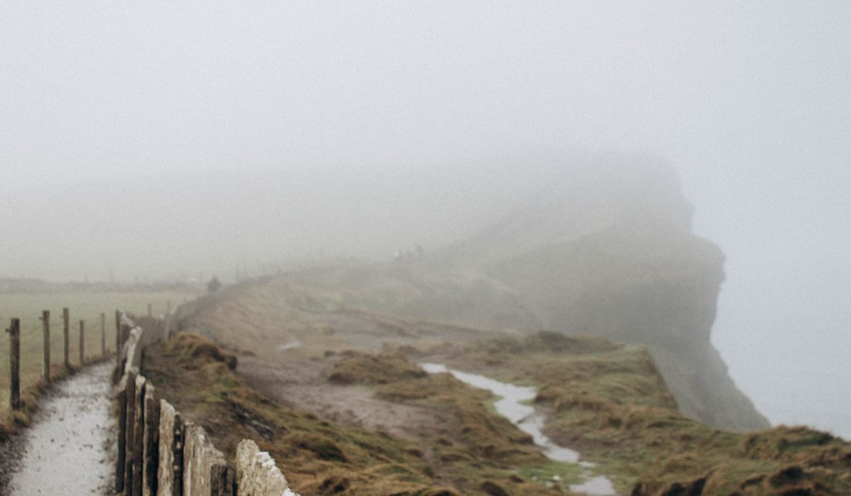
On a coastal walk the sea becomes the dominant force, and the numbers you care about shift. Wind direction matters as much as strength — an onshore breeze pushes spray and sea fog across the path, while a following wind can make an exposed headland feel deceptively calm until you turn for home.
Always check tide times and heights alongside the weather. Many of the finest coastal sections have sections that are cut off at high water, and a rising tide combined with a slow, weather-beaten walker is how people get caught. Swell and sea state are worth checking even from the clifftop: big swell means waves breaking over lower ledges and a wet, slippery path. Sea fog can roll in fast on a warm, still day and leave you navigating a cliff edge in 50 metres of visibility.
Check twice, and watch the trend
One look at a forecast is rarely enough. Check the evening before to shape your plan, then check again over breakfast. What you're looking for is the trend: is the wind building through the afternoon, or easing? Is the front arriving earlier than yesterday's run suggested? Forecasts are revised constantly, and a two-hour shift in the timing of rain can be the difference between a dry round and a soaking.
Compare more than one source if you can, and pay attention to where they disagree — that's usually where the uncertainty lies. Nowcasts, updated hourly, are excellent for the day itself.
Deciding when to turn back
Set your limits before you leave the house, while you're warm and objective. Something like: "If gusts exceed 45 mph on the ridge, we turn at the col," or "If cloud base drops below 700 m, we take the lower valley route." Write it down if that helps. Decisions made on a windswept slope with cold hands are rarely good ones.
Agree a turnaround time as well as a turnaround point, and treat both as real. There's no shame in turning back — the hill will still be there, and the day out is the point. A forecast read carefully beforehand, and re-read honestly on the day, is what turns a hopeful outing into a safe and enjoyable one.



John Doe
14 January, 2022Having no content in post should have adverse..
Chauffina Carr
10 April, 2022We use these tests all time! Killer stuff!
Jim Séchen
16 July, 2022Thanks for all the comments, everyone!